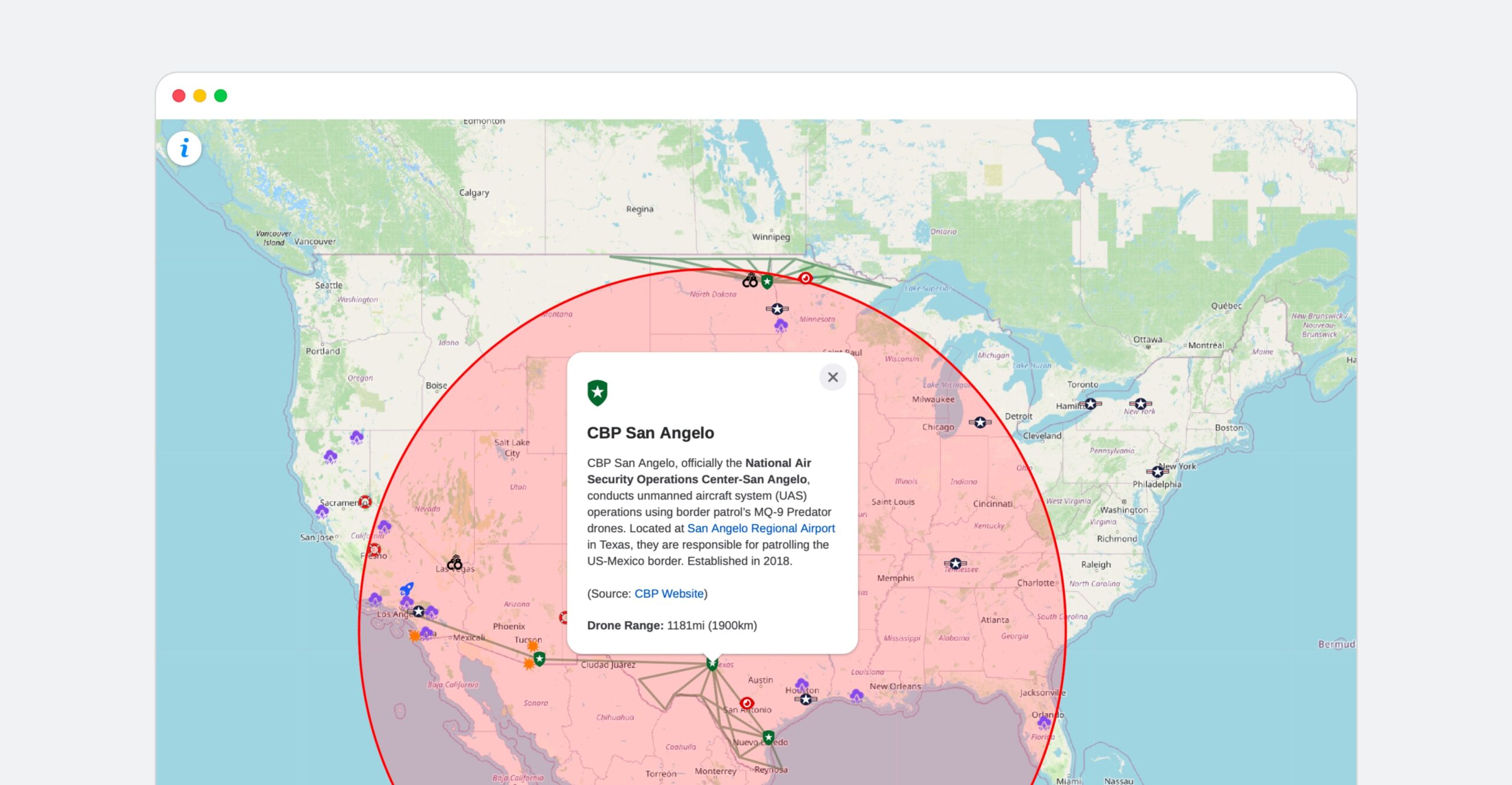
Overview
Predators in the Sky is a mapping and public information project that traces the geographic locations of Predator drone deployments within the United States. It reveals how the federal and state governments in the U.S. have used Predator drones to support law enforcement, immigration, natural disaster response, and search and rescue operations.
The project was completed as part of an independent study course on Surveillance, Cybersecurity, and the Critical Digital Humanities that I took at the University of Toronto. It was supervised by Dr. Jennifer Ross.